Skip to content (Press Enter)
Scottish Outdoor Access Network

Scottish Outdoor Access Network

For people working in outdoor access across Scotland

  • Home
  • About Us
    • History of SOAN
    • Our Mission
    • Our Committee
    • SATIN
  • About Access
    • History of Outdoor Access
    • Outdoor Access Today
    • Managing Outdoor access
    • Active Travel
  • Join Us
  • Events
  • Ask SOAN
  • News
  • Privacy Policy
Scottish Outdoor Access Network

Scottish Outdoor Access Network

For people working in outdoor access across Scotland

  • Home
  • About Us
    • History of SOAN
    • Our Mission
    • Our Committee
    • SATIN
  • About Access
    • History of Outdoor Access
    • Outdoor Access Today
    • Managing Outdoor access
    • Active Travel
  • Join Us
  • Events
  • Ask SOAN
  • News
  • Privacy Policy
The point of a green arrow and a Saltire

Case Studies

22
  • Bankier Primary School Path, Banknock, Falkirk
  • Connel Ferry Station School Transport Improvements
  • Bracklinn Bespoke Steel Timber Bridge
  • Cawder ‘Warren Truss’ Bridge
  • Dorrator ‘Steel Truss’ Bridge
  • Delivering Upland Path Maintenance in the Cairngorms
  • Geocomposite – Lochgilphead Shared Use Path
  • Upland path repairs protecting Steall Gorge
  • Rural Path Surfacing – Islay, Argyll and Bute
  • Ultitrec – Wilkies Path, Drymen
  • Use of Locally Won ‘As Dug’ Materials for Path Construction
  • Use of KBI Flexi™-Pave on Trans Pennine Trail
  • Auchterarder Shared Use Path, Phase 2
  • Loch Earn Railway Path
  • John Muir Way (Blackness to Bo’ness Section)
  • Bridgeness Biodoversity Project
  • Clyde Walkway – Use of Smart Surface® Soil Stabilisation Technique
  • Bowline Project at Bowling Harbour, Glasgow
  • Welcome to the SATIN Case Studies
  • ‘Mires Path’ Boardwalk Replacement
  • Battleby House to Redgorton Active Travel Path
  • Stockingfield Junction Footbridge, Glasgow
The point of a green arrow and a Saltire

Technical A to Z

3
  • Access Control and Management
  • Welcome to the SATIN Technical A – Z
  • Access Authorities
The point of a green arrow and a Saltire

Training

1
  • Scottish Access Rights Training Course
View Categories
  • Home
  • Ask SOAN
  • Case Studies
  • Upland path repairs protecting Steall Gorge

Upland path repairs protecting Steall Gorge

< 1 min read

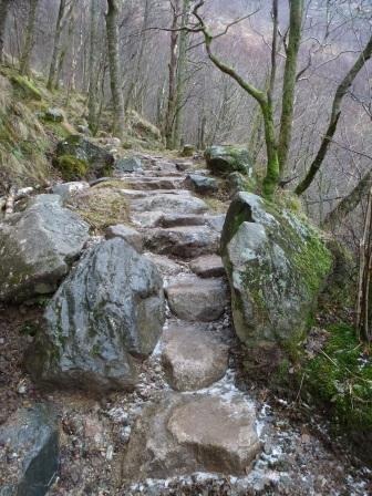
A path through Steall Gorge has existed for centuries but the current path was probably formed in the late 1920s and was badly eroded. Although the path to Steall Gorge was constructed historically, it is still a rough and rugged path to walk and that is part of its character. The number of walkers using the path combined with the steep terrain and heavy rainfall of the area means that the path gets a lot of wear and tear. Although it was still in a reasonably good condition, in 2012 there were some sections where the soft outside edge was beginning to collapse and other places where water run-off was eroding the path surface, making it rougher and causing people to walk on the grass along the path edge leading to additional erosion. If left these on-going processes of erosion would have lead to bits of the path crumbling away, a loss of vegetation and soils, and the path becoming less accessible. Path repair works completed aimed to consolidate the existing path and provide further protection from erosion whilst maintaining its rugged character.

Download the case study.

Updated on 12 October 2025
construction construction materials path surfaces Upland Path

Was this useful to you?

  • Happy
  • Normal
  • Sad

Share This Article :

  • Facebook
  • X
  • LinkedIn
  • Pinterest
Geocomposite – Lochgilphead Shared Use PathRural Path Surfacing – Islay, Argyll and Bute

Copyright © Scottish Outdoor Access Network

Privacy Policy

Scroll